Archives: 31 de mayo de 2018

Darien Gap: the good, the bad and the ugly.

When we thought about crossing Latin America comes the dilemma for all travelers who use their own means of transportation: the so-called Darien Gap, a jungle zone between Panama and Colombia that cuts the Pan-American highway in two. There are no roads there. Zero. The reasons why there is no road continuity in this area are several: from topographical to sociapolitical, such as keeping in order the flow of immigrants (mostly Cubans, but also Africans) seeking for the «American dream». Although the absence of a road between these two countries limits the transit, does not mean that eliminates it. On this last point I will expand later.

All of the above lead us to look for alternatives for our bike trip. There are three options, with mixed prices and amenities: (1) the crossing with, mostly westerners sailboats, which costs up to US $ 600 per person, (2) the crossing by plane from Colombia or Panama, which is around US $ 200 (only per passenger, does not include the cargo), and the cheapest, and chosen by us: (3) the crossing with three motor boats, which can cost around US $ 200 per person, all included.

Since everything described above can easily find on Google, I will tell you about our experience, with all the good, bad and ugly. The following story that I will detail happened between the 1st and 9th of March of 2016.

Once in Turbo, Colombia, it was a little difficult to find accommodation. There are many lodging options given the situation of this city as a sea «bridge» to Panama, but the day of our arrival was all covered, except a place with a price of COP$ 40000 (about 14 US dollars) per room {*COP stands for Colombian peso}, being the most expensive we paid in the Coffee lands. In any case, it’s still cheaper than Chile.

Solved the issue of accommodation comes the most complex, so we started looking for a safe and cheap way to get to Capurganá, border town of the Colombian Caribbean where the migration office is. This is not simple. Well, actually it’s when you’re traveling with the minimum (like a backpack).

After going to the dock called «el waffe» and talking with the people of a company that does not guarantee us the way our bicycles should go (maybe we have to disarm them) or the amount of money that will cost, we decided to look for other companies on the Internet. Voilà! The company that responds to all our concerns is called Ecoviajes Darién, who owns a catamaran that makes tourist trips to Capurganá three days a week. With everything clearer and pre-paid places, we left to the dock to take the boat on March 3rd. About the costs, the ticket per person was COP$ 70000 (about 24 dollars). At first we were told that they were going to charge for luggage (I mean, for the weight of the stuff we carried) and bicycles, but with the rush of the departure the crew only charged us the passengers tickets (so no extra expense ¡yay!) Fortunately our bikes were tied to one of the structures, in the back of the catamaran, a great position considering the strong pounding the boat received every time it smashed against a wave. FUN FACT: If your stomach is weak, sit as near to the back of the boat as possible. I had to do it. At least I could hold my breakfast.

After around two hours of travel, we landed in Capurganá near noon. There, the immigration commander approaches, he says that we are welcome to stamp our passports in the office whenever we want, but we have to be clear when we’ll leave to Puerto Obaldía, Panama. We sealed the passport during the afternoon, because we planned to leave the next day. Apparently the boats leave from Monday to Saturday and fill fast (each boat accommodates up to 10 passengers).

That Friday, March 4th, we started early, because the boats leave around 8 am, so you have to weigh the cargo before leaving. The cost per passenger was COP$ 30000, COP$ 20000 per bicycle and the load costed 800 pesos per kilogram, but the first ten were free. With a little bargain we got a small discount: we paid at the end $40000 for the load (Sylvain’s stuff and mine). I could only negotiate for the price of the luggage and this is possible because the boatmen do not give a receipt for any service.

TIP: You have to be careful with the way you load the bicycles and remove all the steel parts because the salt water will do its job destroying them. A few Days before, on our way to Turbo, we met two French cyclists who made this same trip (coming from Panama) and unfortunately one of their bikes was left with the rear derailleur completely unusable, plus a bent wheel with some of the spokes destroyed by the struggle of some passengers to remove part of their luggage, plus the pounding of the boat. Their bicycles were stored on top of one another on the front part of the speedboat, which received the strongest impacts of the waves. Considering this experience, we removed as many fragile parts as possible. The bags had to be tightly closed and it’s better to travel with sandals (or any type of footwear that is easy to rinse) because this section is short but rough and wet (lot of splash from the waves).

That travel lasted about 1h and then we arrived at Puerto Obaldía, Panama. We were met by SENAFRONT, an organization that protects the borders of the country and that checks the cargo of all vessels. What struck me most is that if they check your gear as if you were a dangerous trafficant, but they do not tell you what they are looking for, unless you ask them. Although the first thing that could come to my mind is illicit drugs, don’t you think? The backpackers who traveled in the same boat had to open all their luggage and enjoyed a meticulous examination of absolutely all their pack. In our case, they only check our bags with an anti-narcotics dog.

After the review, we went to the migration office in Panama, where they gave us the entry stamp, also took our fingerprints and a photograph. To make this process you must also bring a copy of the passport, specifically the page with the traveler’s information. I recommend making a copy in advance, to reduce costs. Note: the Panamanian currency is officially the Balboa, but it’s nothing else than the US dollar. The balboas are just the coins, the bills are US (yes, I do not understand this system either, but that’s the way it works).

Officially in a new country, we went to a quiet place dry our clothes and chill out after passing this first non-cycling part of our journey. The offers of boats departing to Carti were easily spotted (no idea about the cost), but we preferred to spend the night there and wait for the next day to keep going. No hurry … for now.

At night we camped on the side of the town, near the garbage dump.  This small village is the entry point of hundreds of Cubans who use this part of Central America to access the United States. They had the possibility of obtaining the right to enter and stay permanently in the USA until January 2017, due to the Law of Cuban Adjustment, a mechanism that since 1966 allowed the islanders to enter gringo lands. The issue of the floating population in Puerto Obaldía is so transcendent that it’s present in the media.

The next day arrived and no boat leaves to Carti. We begin to worry that the issue of the departure of this «limbo» will take more time, but the next flight to Panama City leaves in 10 days, and without ATM or enough food we have no choice but to follow with the marine travel plan, save food and money. The flights are daily, but taken mostly by Cubans, so the seats are filled very quickly.

Saturday follows its course and nothing happens. On Sunday, we saw a boat called «Idayana 2» coming from Carti with three cyclists. Sylvain chatted with them a little, they seem satisfied with the service, their bicycles arrive in good condition because the boat has a space in the bow to keep the bikes upright which kept them safe; placing them lying down could put at risk the integrity of certain parts, such as the racks.

I approached the manager of the boat. He offered me a price of US $ 150 for each person to take us to Carti. The price includes the transfer of the bicycle and luggage. I asked him if he could give us a discount but he said that would not be a problem as long as the boat was filled.  That would mean 5 more passengers. Since I have no power of persuasion, I hoped that time passes; being near the beach for two days we saw people coming and going, I know that some of them will continue the travel to Carti. The reality is that the next day the boat is ready to depart with 5 more passengers.

Finally we paid US $ 125 (per person) for the route that moved through the archipelago of San Blas and then the boatman asked our passports to start a process that I never understood exactly what for. We had not received a receipt for the payment, ergo, the only guarantee we have is that the boatman remembered us. Some called that trust; to me, a lack of respect for the client, especially when he returns and says: «Did you pay me?” My internal Gordon Ramsay was in my thoughts: “asshole, I gave 250 dollars in cash, don’t ask me more shit!».

While waiting to leave, a man approaches, asking us if we are going to Carti. We were warned that we had to pay a toll of US $ 20 to go through the islands in the Guna Yala region. The permit would cost double if we do not do it in Puerto Obaldia. I got angry, because after almost 4 days waiting,  this was the first time I heard about this and it seemed like a scam, however I calmly replied that we are not going to pay, and that any problem would be fixed later. We didn’t want to give money that easily: we spent enough money for the trip and we have barely eaten in three days with the prices that there were in the town (5 dollars for a very poor plate of rice with tuna that would be a shame for a undergraduate student). Later I understood that the whole issue of boat transport in that area was handled almost exclusively by gunas, the ethnic group of that area.

Dodging the theme of the fare and done with the process of the boatman, we left almost at 11 a.m., when we should have left at 8 a.m. I thought «Patience, maybe the best is yet to come and we can still get to Carti during the afternoon. Yes we can!» My initial optimism leaves aside the hunger we have felt for 3 days- only breakfast was a proper meal- and is accentuated by the beauty of the archipelago and the tranquility of the water in most of the lenght. I talked to Sylvain; we tried to leave behind all the waiting and uncertainty. We enjoyed the landscape.

The boatman made two stops: one to get gas and another to pass to his dad’s island. Yes, you read well: his father has an island, the kind with a postcard-travel agency landscape: palm tree, white sand and turquoise sea. There we got off the boat and after almost half an hour we continued the trip. It’s close to 4pm and maybe there’s still time to get to Carti. In the distance we saw a town on the coast, there it is, maybe 500 meters or less, but the boat starts to turn to the right and enters an island crowded with stilt houses. I asked the boatman “when we go to Carti?, we need to arrive today”. He said “no, tomorrow we leave”. What?! This seemed like a bad dream that does not end! The place where the boatman takes us is a shitty bar / lodging where, conveniently, he is the owner. Unfortunately, because this place is an island, it’s super crowded and you can not camp outside, so we decided to wait for the bar to close at 10pm and sleep on the floor, because we would not pay more money for the deficiency of our carrier.

Tuesday (March 8th 2016) morning arrived and we did not exchange any more words with the boatman, we just wanted to arrive to land and finally start to pedal, because we know that someone was waiting for us with accommodation in Panama City.

At last we arrived at the pier of Carti. We disembarked and packed our cargo on the bikes. The expected pedaling is coming. Not even 10 minutes pass and someone asked us to pay US $ 2 for the use of the pier, to which I reply that it is not up to us because we did not decide to arrive at this dock and there was not a single sign that explains this fee.

Here is where the most serious problems begin. We pushed our bicycles towards the road and a man approaches insisting on the payment of the tax. I explained that I’m not going to pay it, that it’s up to the boatman – since when the passengers pay tolls? – that I’m leaving and that if he has any problem with us, he could call the police. Then he beginned to push my bicycle back by the handlebar, another man joined him to do the same. The struggle got stronger and with me trying to explain that I will not pay. For what is worth Sylvain was not held by anyone, apparently the Guna men (about my height) are afraid to face him with the payment. The struggle continued, until the oldest of them, and apparently the one in charge of the charges, pushed me hard on the shoulder, which made me almost fall with the bike. Sylvain reacted to defend me, left his bike on the floor and runned to push the man shouting «do not touch my wife!” Immediately four men grabbed Sylvain and threw him to the ground, the one who pushed me throws a hit in his face, which cut the lip of my dear husband. It seems that the man filters his violence by the fact that there are too many witnesses (more than 50 foreigners watching), it could be bad for the business. The struggle lasted about 2 minutes and mixes with the comments of the backpackers, some defend the tax, others just wanted to stop the brawl, some recorded with their smartphones (another souvenir).

//Important information: most of the backpackers, who travel to this part of Panama, come from the main city with travel agencies, so they know the cost of almost everything. Mostly I listened voices insisting that we pay the tax, which is fair because it is guna territory. I think the tourists think this is cheaps cause, that’s why they only «lower their pants» with the usurious costs of this area.//

At the end, a man who didn’t look like a Guna and with a Panamanian accent paid the 4 dollars because he was embarrassed by the scene. Well, I’m ashamed that the Panamanian government does not control the charges in this area or that the prices aren’t set on signs, as is the case in many protected areas around the world.

Later I would find out that the Guna Yala Comarca is an autonomous territory, with its own rules, that is, they can charge what they want because there is no police control and most of the people think is ok because it is a very nice place, there’s no doubt about that. The region is something like a Far West of the Caribbean, except that the weapons are replaced by intimidation and usury.

After spending the worst moment of our entire trip, we started pedaling. I stopped and started crying. It wasn’t sadness, it was fear. I had never felt so much fear in foreing, not even in Colombia, a country that has a terrible reputation for insecurity but that is badly argued, at least in our experience. The intense feeling of anguish accompanies me all that day, I attribute it to the little protection I felt and to the violent reactions that the merchants had against us. For my good fortune I have the support of Sylvain, who in spite of the hit he told me that he is well and that all this only reminded him when he used to play rugby 🙂

That day we cycled little because of many factors: the heat, the exaggerated inclination of the road, the post-altercation moods and the hunger that already extends for 5 days. We camped and rested well, in spite of feeling the target of possible attacks, since we still had not left the Comarca.

The next day (March 9th 2016), our spirits seemed to improve, the road was very difficult and every kilometer was an achievement, despite the fact that we had to push and not pedal in many places.

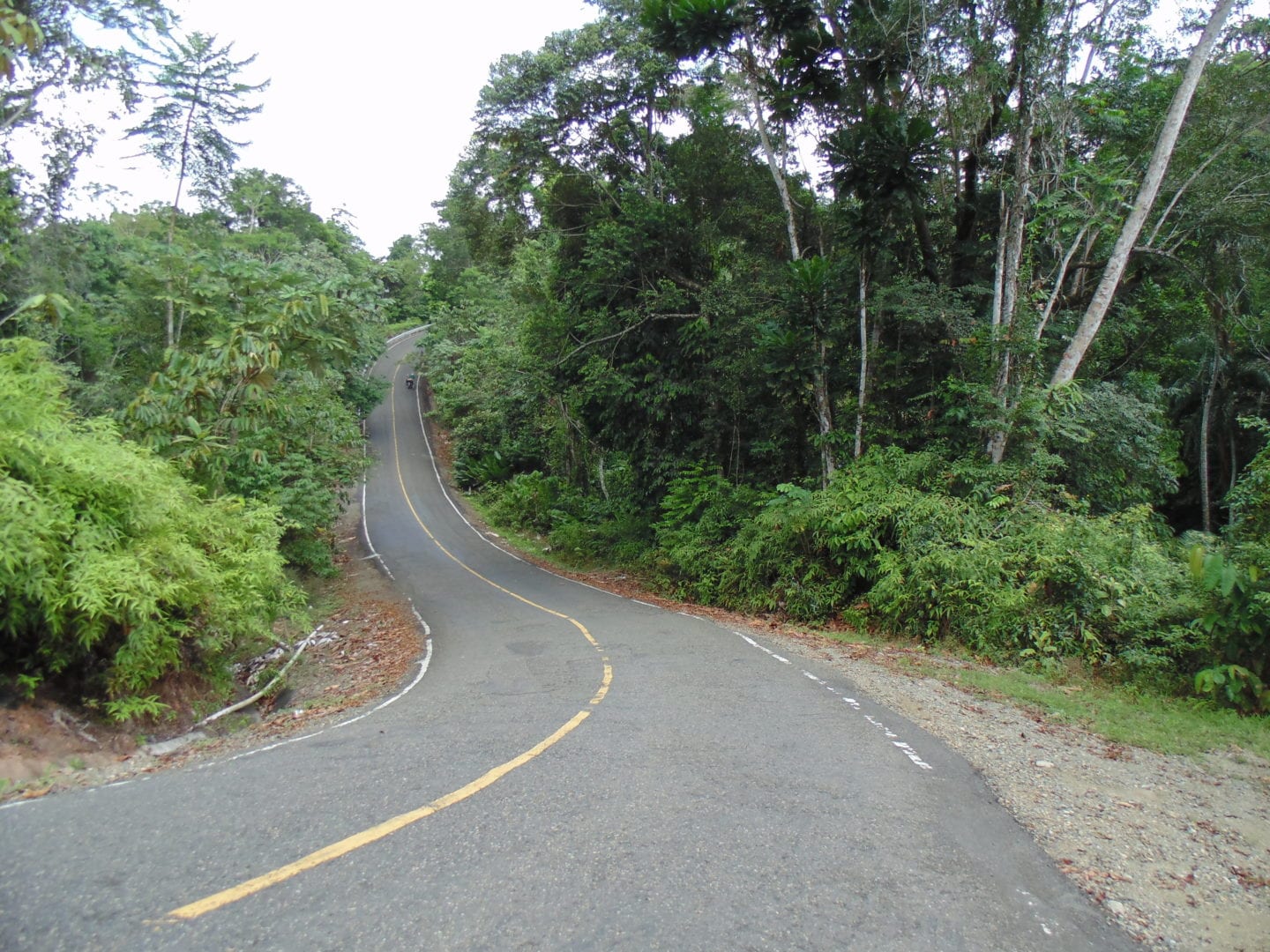
In the way to the Panamerican from Carti, we couldn’t pedal properly due to the steepness of the road

Around noon we move forward when we saw a man in the distance filming us with his phone from the middle of the road. It turned out to be an inspector at his checkpoint. He asked us if we were the ones who hit his partner, I answered that this attack was in self-defense. He stopped recording. I asked him what he wanted. He told me that we had to pay a transit fee, that everyone who goes there pays for it because it is a protected area. Do you remember that man in Puerto Obaldia I mentioned before? Well, he was right, the transit fee is 20 dollars (per person) and this is the place where you must pay. This time we took the option to dialogue and not move against the will of the managers. The truth is that you can not discuss the payment, so we paid, they gave us a receipt and we continue. Also in that place there must be 10 men intimidating with their presence so that the payment was made, since we didn’t want more free violence.

In the afternoon we arrived at the Pan-American Highway and begin the journey to Panama City. After all the above, cycling along this route seemed like a walk in the park and accompanies it with a great breath of relief. I never repeat this experience again.

Once we reach the Panamerican this is the only info sign there.

EPILOGUE

In hindsight there are several conclusions and observations that we drew from this:

The first is that after reading several blogs of users going the same way, but without mentioning the issue of taxes, was the main reason to write an extensive entry like. This should be clearer, especially for those who travel from South America. This trip was expensive and coming from the south, we are not used to carrying so much money with us. On other hand, from the information we collected from other blogs, travel by plane Medellín-Panama (or vice versa) was cheaper and faster.

I advise patience with all the payments. We weren’t and look what happened. However, I don’t recommend at all to do this way, but if you plan to do this because you want to add more “adventure” in your great bike trip throught the Americas, take a large amount of money, even if you could negotiate the prices.

Remember, do not expect receipts or vouchers. Maybe this last is not important for many, but as an accountant’s daughter, I have this embedded in the upbringing, and perhaps even in the DNA.

Although we made several mistakes in not informing ourselves of the particular situation in Guna Yala Comarca, I must say I found very shady that the Panamanian government did not get involved in the issue of payments with tourists, especially if there is no safe option to travel by land between this two borders. The region should be one of the poorest regions of Panama, but every day thousands of dollars go into tourism that remain in the hands of a few and taxes are imaginary, I say this because there are no bills or receipts for transportation, the charges generate profit and the feedback isn’t enough for the majority of the inhabitants. It’s a matter of seeing the availability of basic services such as drinking water and health in the island settlements. Also the issue of garbage is not important; I observed many wastes (cans, bottles, bags, etc.) on the seabed, also along the road. Looks like the “protected area” is a flexible concept.

The Guna ethnic group has lived for years in this area and deserves a place of its own as guaranteed by the government of Panama, but the region is not a separate country and I believe that the people who run touristic businesses there (who are a minority of the ethnic group) takes advantage of its autonomy to charge in excess, even to the Panamanians themselves, as later we talked with some.

After leaving Panama City we learned the following: The brawl that we had catalized, without us making any official claim, a discussion of tourist charges in the region. Part of the altercation was recorded and shown on Panamanian television (TVN), without our consent, and added to other similar conflicts with tourists generated a wave of complaints that made the government begin to pay special attention to this issue. All this reflects a real problem that not only we live. It is not the first time there are conflicts with payments and it could probably continue to happen.

FOR MORE PHOTOS VISIT THE SPANISH VERSION


Wallmapu: entre araucarias, lagos y montañas.

El 4 de enero, salimos de Chillán con dirección a Los Ángeles, a unos 110 kilómetros de distancia. A pesar de tener lluvia en los primeros kilómetros continuamos el recorrido por la Panamericana o ruta 5 (en Chile), que como otras veces fue tedioso pero efectivo, los que han pedaleado a lo largo de la ruta 5 saben a lo que me refiero.

Planificamos acampar a mitad de camino, donde hay varias plantaciones forestales. Escogimos la de aquella noche porque contaba con acceso peatonal sin cerrar, que para nosotros quiere decir que cualquier puede entrar. Al día siguiente aprovechamos de llegar temprano a Los Ángeles a casa de Margarita y Luis, padres de una mis mejores amigas. Usamos también la oportunidad de visitar a una amiga, Fernanda, y ponerme al día con su vida.

Después de 2 noches en la ciudad, seguimos con el plan de viaje, que consistía en cruzar a la región de la Araucanía por medio de la cordillera, trazando una ruta inhabitual, incluyendo unos kilómetros sin camino para vehículos motorizados pero si con un sendero comúnmente usado por arrieros, entre Lepoy y cerca de Troyo. Esta desunión vial entre dos regiones es muy común en nuestro país y muchos cicloviajeros decirse quedarse con el status quo de la Ruta 5.

Al segundo día de nuestra partida comienzo a sentir un ruido extraño al frenar. A simple vista parecía no existir un problema, por lo que continuamos hacia el Este, bordeando el rio Biobio.

Vista del rio Biobío, parcialmente estancado por el embalse Angostura.

El 8 de enero pasamos por el pueblo de Ralco, luego la central Pangue hasta dejar el asfalto; el ripio nos acompañara por un par de días. Esa tarde hicimos unos 20 kilómetros entre polvo, calaminas, calor y mucho tráfico (incluido buses), que nos sorprendió dado el precario estado de la ruta. Al atardecer buscamos un lugar para acampar tranquilo, que nos tomó más de una hora encontrar. Instalados, Sylvain revisa mi bicicleta y encuentra una falla que cambia completamente nuestro plan de continuar: la llanta se trizo, haciendo muy peligroso frenar (mi bicicleta cuenta con sistema V-brake) ya que los kilómetros venideros poseen pendientes muy pronunciadas, también en ripio.

Central Hidroeléctrica Pangue

Rio Biobío.

Yendo a Ralco hay varias vistas que resaltan.

Asi como otras del camino que se nos viene.

De regreso a Los Angeles.

No todo el camino al oeste es en bajada, pero al menos la vista se maravilla.

Con la decisión tomada, volvemos a Los Ángeles, con la mente fija en encontrar una llanta para mi tipo de maza. Afortunadamente, nuestros amigos nos reciben nuevamente sin problemas y volvemos a pedalear el 11 de enero, esta vez con otro plan, un poco más convencional, pero aun con la meta de cruzar hacia Argentina.

El comienzo del fin…

Avanzamos desde Los Ángeles a Victoria por la Panamericana (Ruta 5) con dirección al este por la ruta 181Ch, pedaleando por Curacautín, Manzanar y Malalcahuello. Destaco que entre estas últimas dos localidades hay una ciclovía, que reemplaza lo que fue la vía férrea.

Parte de la ciclovia Manzanar-Malalcahuello.

Desde la ciclovia se puede observar la punta del volcán Lonquimay.

El camino desde Victoria hasta Manzanar presenta varias curvas, pero el real problema surge al llegar al Túnel Las raíces, de 4 kilómetros y medio de largo y con tráfico controlado por un semáforo, ya que cuenta con sólo una calzada. Como muchos túneles, la tracción humana está prohibida, entonces debemos recurrir a que un alma caritativa cuente con suficiente espacio en su vehículo para transportarnos. Hacemos “dedo” por uno par de minutos y un hombre con un pequeño camión se detiene, con suficiente espacio para no tener que sacar toda la carga de nuestra bici ¡nuestras plegarias son respondidas! Recorrer un túnel con el pelo al viento a más de 60 km/h fue algo que no vivíamos hace casi 3 años, desde que nos transportaron (también en un camión) por el túnel del Cristo Redentor en la V Región camino a Argentina.

Nos despedimos muy agradecidos de nuestro transportador para seguir 10 kilómetros pedaleando hasta la intersección con la ruta 955, donde empieza el ripio que nos lleva a la comunidad Quinquen, laguna Galletué e Icalma. Dos días de circular entre bellas araucarias y llanuras bordeando ríos y lagos hasta el Paso Icalma (1298 m.s.n.m.), donde entramos a la ruta 13 de Argentina el 15 de enero, para doblar hacia Moquehue siguiendo la Ruta 11, inmersa en el circuito Pehuenia. Todo este trayecto, hasta la ruta 23, es de ripio con diferentes grados de ondulación, así como de tráfico, que es de esperar dada la temporada en que nos encontramos.

En la ruta 181, al este del túnel Las Raíces. Sierra Nevada al fondo.

A unos kilómetros camino a la comunidad Quinquen las araucarias hacen su aparición.

¿Cuantos años tendrá este alto ejemplar?

Al entrar a zonas aledañas de los lagos Icalma y Galletué el cerco está bien presente.

Lago Galletué, uno de los cuerpos de agua que engendra el rio Biobío.

El 15 de enero cruzamos la frontera a Argentina. Este letrero no es mi primera vez que lo vemos.

Las araucarias al otro lado de la cordillera.

Gracias a la cercanía de diferentes cuerpos de agua, hay varios puntos para refrescarse. En el rio Pulmari nos bañamos y lavamos nuestras ropas antes de encontrar el lugar perfecto para pernoctar.  

La ruta 11, que bordea los lagos Moquehue y Ñorquinco (por mencionar los más grandes) es de ripio. Sin embargo en algunos tramos se encuentra en muy buen estado.

El 17 de enero llegamos a la ruta 23 (asfaltada) que, en dirección hacia el Sur, nos destina a Aluminé, pueblo con casi 5000 habitantes, donde nos detenemos por un par de horas con la misión de cambiar plata. Lamentablemente nuestra búsqueda es infructuosa y recurrimos a la única opción, adquirir pesos argentinos con el dueño de una tienda. Lección aprendida: próxima vez hay que conseguir plata con antelación.

Las cosas han cambiado mucho en Argentina, y la visita al supermercado nos impresiona al ver los precios de ciertos productos, que en el 2015 nos parecían más baratos comparados a Chile. Quizás esto puede ser por la ubicación (zona turística) o la temporada en que nos encontramos, o por la inflación que ha vivido Argentina últimamente, pero definitivamente nos parece casi todo más caro.

A unos 18 kilómetros al sur de Aluminé el asfalto se termina, exactamente cuando el camino cruza al lado este del rio con el mismo nombre. El trayecto se nos hace un poco más liviano por el hecho de que vamos en descenso, pero la ruta tiene tráfico de camiones y varias veces tuvimos que detenernos para no desaparecer entre todo el polvo.

A lo largo del camino que va bordeando el rio, el cerco es sistemático, excepto en los accesos para pescar (donde no se permite acampar) indicados con un letrero y numero. Esto es muy agotador, porque incluso no se puede adentrar a los arbolitos para hacer pipí. Felizmente, al final de la jornada y muy cansados, encontramos un lugar donde no hay cerco, pero con suficiente vegetación para camuflarnos del camino.

Camino (ruta 23) que bordea el rio Aluminé.

Las calaminas de la ruta 23, que bordea el rio Aluminé, son más fáciles de llevar cuando no hay vehículos pasando. Pero el polvo que se levanta más adelante nos muestra que pronto tendremos compañía.

La constante presencia del cerco no solo termina cuando dejamos de lado el rio Aluminé, muy cerca de un pueblito llamado Pilolil, es casi permanente hasta el Suroeste de San Martin de Los Andes. Estas estructuras divisorias son inútiles muchas veces, porque a lo largo del camino vemos caballos galopando, vacas pastando y algunas cabras.

El volcán Lanin nevado.

El 18 de enero llegamos a Junín de los Andes, con el anhelo de encontrar un camping con electricidad y Wi-fi, solo porque estos dos lujos no podemos encontrarlos en la naturaleza. Las opciones en esta ciudad se reducen a dos: el camping municipal, que no cuenta con internet, y otro lugar que si tiene, pero con un costo un poco mayor. Al final nos decidimos por el segundo, aunque el Wi-fi no funciona como esperábamos.

El 19 de enero continuamos camino por la ruta 40 hasta San Martin de los Andes. En este trecho comienza un cambio de paisaje, dejamos atrás la estepa e iniciamos el viaje por el bosque patagónico y con tantos lagos que se me hace difícil poder identificar uno del otro. La fertilidad del bosque se ve acompañada en cientos de vertientes por el camino hasta empalme a Villa La Angostura. Muchas de estas tiene agua potable (tomamos agua de varias).

Por estos lados es fácil tener un acceso a agua y, en muchos casos, esta es potable (lo comprobamos así porque no tuvimos que correr al baño)

En la cima de la cuesta aledaña al lago Lácar, Argentina.

Nos cruzamos varias veces con cicloviajeros que, en su mayoría, viajaban en grupos, con poca carga y de nacionalidad argentina. Al pasar por estos lados, entendimos el atractivo de la zona, a pesar de que la berma no acompaña siempre.

Al terminar la cuesta que asciende al sur del Lago Lacar y después de pasar el arroyo partido encontramos un lugar para acampar de esos que invitan a quedarse más de lo esperado, y con mayor razón, ya que al día siguiente pronosticaron una tormenta eléctrica. El lugar está al interior de un bosque donde corre uno de los brazos del arroyo ya mencionado, perfecto para un baño refrescante. Descansamos dos noches allí.

El 21 de enero continuamos por la ruta 40 bordeando lagos y bosques hasta el empalme que divide el camino. Elegimos el camino hacia el Chile, ruta 231, por al paso Cardenal Samoré. Esa tarde decidimos acampar muy cerca de la aduana (a 1,5 km), ya que la app iOverlander indica que hay espacio para pernoctar en la Laguna Pire. Como no estábamos seguros si se podía acampar, ya que está dentro del Parque Nacional Nahuel Huapi, nos mantuvimos fuera de vista del camino, en caso que apareciera un guardaparques. De todas formas, al atardecer, aprovechamos de darnos un baño en las aguas poco profundas y tibias de esta laguna.

Algunas partes de la ruta 40 tienen berma.

Al día siguiente hicimos el protocolo para salir de Argentina. Nada de revisión de carga, solo control de inmigración. Comenzamos a subir al Paso Cardenal Samoré (1300 m.s.n.m.), la distancia del ascenso son 16 kilómetros, con unas partes más inclinadas, pero donde la sensatez de vialidad domina la distancia. Llegamos a territorio chileno el 22 de enero (a una semana de la salida) . 

Subiendo al Paso Cardenal Samoré. Luego de una semana en Argentina decidimos volver: el motivo fue principalmente el mayor costo, comparado a Chile, con los alimentos. Al fondo, Cerro Pantojo.


Rendez-vous au Chili: de Calama a Chillán.

Esta parte del trayecto fue un tanto novedosa, pero predecible en otras partes. Desde Calama hasta Coquimbo pedaleamos por paisajes nuevos, al menos para mi, ya que Sylvain había pasado por algunas rutas por el 2012.  Pero de Coquimbo a la capital nacional tomamos un bus, es decir, no mucho que contar. Tomamos esta decisión luego de contraponer el dinero invertido en el mismo viaje versus al precio de los pasajes y la alta posibilidad de que, al pedalear por una zona muy poblada como esta, no encontraríamos fácilmente lugares para acampar. Ademas de encontrarnos en una fecha muy próxima al invierno del Cono Sur, que significaría pasar varios días circulando bajo lluvia, suceso que si nos ocurrió al sur de Santiago. Por esto mismo, no me explayare demasiado con el escrito, sino que describiré algunas partes por medio de las siguientes fotos:

Tramo destacado en naranjo (con bicicleta) y verde (con vehículo motorizado) desde Ollagüe hasta Chillán. Para más detalle del mapa, haz clic aquí.

Por la ruta 25, desde Calama hasta cerca de Antofagasta, hay varias ruinas de oficinas salitreras, las que funcionan muy bien como refugio nocturno.

En general las rutas asfaltadas del norte, como la ruta B-710 (acceso al Observatorio Paranal) en la foto, poseen berma. Nosotros tratamos de pedalear lo menos posible por la ruta 5 para evitar el tráfico y tener más acceso al clima menos extremo de la costa.

Entre Paposo y Antofagasta se nos presento un grave problema: una llanta trizada (en la foto se nota clarito arriba de la «NE»). La solución para esto es un reemplazo de esta parte por una en buen estado. A pesar de enfrentarnos a una cuesta muy inclinada que desciende a Paposo, nos decidimos a seguir hasta Taltal para comprar lo que pudiésemos encontrar, contrapesando el riesgo de que Sylvain no pueda frenar en la bajada. Afortunadamente antes de la cuesta, un hombre que transporta trabajadores mineros nos ofrece llevarnos al pueblo, ya que tenia espacio suficiente en su van.

A unos kilómetros al sur de Taltal, y luego de comprar una llanta de segunda mano, encontramos un lugar perfecto para que Sylvain trabajase armando su nueva rueda delantera.

Protegido del Sol, al costado de nuestra carpa, Sylvain logra terminal la rueda con éxito esa misma tarde, como el prolijo mecánico que es.

Pedalear por la costa del Norte Chico y Grande consta de subidas y bajadas constantes pero no extensas como en otras partes del mundo.

Al sur de Taltal se encuentra el Parque Nacional Pan de Azúcar que posee unos bosques de cactáceas, constituidas por especies del género Copiapoa

Detalle de una de las Copiapoa.

En Caldera, Región de Atacama, nos dirigimos al sur por la ruta C-302. Las nubes nos acompañan por varios días pero no las precipitaciones.

Los caminos que trazamos desde Caldera hasta Huasco están compuestos de tierra compactada, muy confortable de circular en ellos, a diferencia del ripio.

La humedad del ambiente ayuda a que las plantas comiencen a desarrollarse hasta llegar al esplendor del desierto florido del 2017.

Entre el verdor podemos divisar algunas bandurrias que aprovechan de comer del suelo húmedo en el Parque Nacional Llanos de Challe. 

La vista del rio Huasco nos indica la entrada a áreas más agrícolas, como de donde viene el producto estrella de esta zona: la aceituna.

El norte de Chile posee cualidades excepcionales para la observación astronómico. Una de las instalaciones dedicadas a ello se encuentra muy cerca de La Serena: en la foto observatorio La Silla.

La ventaja de usar la ruta 5 norte, entre Vallenar y el limite con la IV región, es la posibilidad de observar la cordillera de los Andes.

Parte de la cuesta Buenos Aires, la cual se extiende desde el km. 513 al 523 de la Ruta 5 norte.

El día anterior de llegar a Coquimbo acampamos a unos kilómetros al sur de Los Hornos, en un tramo donde hay algo de arbustos.

Un -spoiler del desierto florido 2017.

En Coquimbo, tuvimos la fortuna de ser hospedados por Bárbara, una antigua amiga de Concepción.

Después de varias aburridas horas de viaje en bus, llegamos a Santiago, específicamente a la casa de mi hermana, Sofía, quien nos recibió cariñosamente con un clásica once chilena.

Lamentablemente, no tomamos muchas fotos desde Santiago a Chillán, porque tomamos la ruta 5 Sur, que es bastante aburrida. Pero si destaco la hospitalidad de Warmshowers en Rancagua (Miguel, Javiera y su familia) y Curicó (Maria Paz y Miguel). En tanto, en Talca, fuimos recibidos por mi buen amigo de la universidad, Matías. 


Altiplano: De La Paz a Calama.

Después de 9 días en La Paz nos retiramos rumbo a Oruro el 3 de mayo. Para evitar postergar nuestra salida, en vez de tomar la autopista que une El Alto con La Paz, escogimos la forma más floja: la línea amarilla del teleférico paceño. Además de ahorrarnos tiempo (el recorrido duro unos 5 minutos hasta la cumbre), no tuvimos que sacar la carga de la bicicleta y el precio es conveniente: el pasaje es de 3 bolivianos por persona -unos 300 pesos chilenos- más el mismo valor por la bicicleta. Destaco que hay algunos inconvenientes, como la falta de rampas en las estaciones (no pudimos entrar en los ascensores para gente en silla de ruedas, pero algunos empleados nos ayudaron mucho con el peso en las escaleras) y que el movimiento de entrada y salida de la cabina debe ser expedito para que no te arrastre con bici y todo hacia otra dirección. Sin embargo, el ahorro de tiempo es significativo y tuvimos una espectacular vista de la ciudad y la cordillera real.

Con otros cicloviajeros en Casa de Ciclista de La Paz, Bolivia. La foto es cortesía de Marie, ciclista francesa que aparece al extremo derecho.

Brigada Ramona Parra presente en La Paz, Bolivia.

Usando nuestro paso por La Paz, visitamos a Marc, amigo belga de Sylvain. Ambos se conocieron en la Casa de ciclistas paceña en el 2012, pero Marc se radico en la ciudad ya que conoció ese mismo año a la que se convertiría en su esposa.

La bicicleta de Sylvain dentro de la cabina del teleférico paceño.

Ya en El Alto, la distancia a Oruro, capital del departamento homónimo, es de un poco más de 200 –ininteresantes- kilómetros por la ruta 1. El tedio del camino se compensa con la seguridad de la berma de esta autopista. El 4 de mayo entramos a Oruro, aunque no pedaleamos por el centro, sino por la circunvalación de la misma ruta 1 por la periferia de la ciudad.

Desde Oruro hasta el empalme con la ruta 30 hay 120 kilómetros, nuevamente, sin mayores dificultades. Luego pedaleamos por la ruta 603, con dirección sudoeste pueblo de Salinas de Garci-Mendoza. La dificultad en todo este tramo se nos presentó como un fuerte viento de frente, pero con la ventaja de un camino totalmente asfaltado, mucho menos tráfico que en la ruta 1 con más espacios para acampar, gracias a numerosas ruinas en el curso del paisaje. Una vez en el pueblo mencionado, el 8 de mayo, nos abastecemos de alimentos y una gran reserva de agua, gracias a la llave que se encuentra en la plaza de armas.

Un par de paredes de adobe ofrecen una gran guarida de la ruta 1 boliviana.

La ruta 603 entrega una panorámica previa al Salar de Uyuni.

El camino desde Salinas de Garci-Mendoza hasta las faldas del Volcán Tunupa es de tierra.

Desde Salinas hasta la entrada del Salar el camino es de ripio y básicamente bordea el lado sur del volcán Tunupa (5300 m). Hasta cierto punto, al este del Volcán, es posible direccionarse para entrar directo al Salar, en vez de pedalear por un ripio mediocre a través de Jirira, Ayque y Coqueza. Elegimos esta opción considerando que ya estábamos en mayo, o sea, ya había pasado un mes desde la entrada del otoño (comienzo de la temporada seca y fría), es decir, los bordes del salar ya deberían estar secos. Pero no tuvimos mucha suerte. Los primeros kilómetros pedaleamos sobre una superficie mojada además de la sal que maculo gran parte de la bicicleta, un souvenir que se mantuvo por algunos días, hasta que pudimos lavar las bicicletas totalmente en Calama. Afortunadamente, llegamos a la zona más seca y compacta del salar, siguiendo mayormente las huellas de alquitrán dejadas por los vehículos 4×4, que acarrean miles de turistas a diario. La experiencia de pedalear, por este gran manto blanco, finalmente se volvió placentera.

A unos kilómetros de entrar al salar de Uyuni ya empezamos a ser engañados por el espejismo del mismo.

Acampada con el vecino salado.

Esto pasa cuando pedaleas por un salar que no está totalmente seco.

El Salar no tiene caminos, pero no hay duda por donde pasan los vehículos motorizados.

Desde el acceso norte a la salida sur hay unos 100 kilómetros. A medio camino se encuentra la isla Incahuasi, uno de los principales focos turísticos del Salar. Disfrutamos un poco menos la segunda mitad porque el viento austral nos empujaba, además la preocupación por la acumulación de densas nubes negras que sugerían que una tormenta se aproximaba. Por supuesto, el Salar de Uyuni no es el lugar para experimentar lluvias densas: terreno muy plano equivale a una alta probabilidad de impacto de rayos, asimismo de ser una zona de acumulación de agua. Así que pedaleamos con mucha prisa para salir de allí por el lado de Chuvica y acampar antes de que oscureciera. Finalmente, no llovió, pero no importa 🙂

Vista del volcán Tunupa desde el sudeste.

Parte de la Isla Incahuasi, en el salar de Uyuni, hogar de numerosos cardones de la puna (Echinopsis atacamensis).

Si disfrutas del silencio, pedalea por el salar más grande del mundo.

Desde este punto hasta la frontera con Chile (Avaroa/Ollagüe) son unos 130 kilómetros de ripio, y no exactamente un camino sencillo: la superficie alterna bruscamente entre zonas de arena y profundas calaminas, aunque en general no hay desniveles significativos. El viento no nos dio tregua por gran parte del Altiplano y este tramo no fue la excepción.

Cuando nos acercábamos al pueblo de San Juan, Bolivia, sobrellevando todas estas condiciones, tuvimos un extraño encuentro con una patrulla de militares en un auto 4×4: querían absolutamente controlar nuestro equipaje, a pesar de que el viento ni siquiera nos dejaba escucharlos y que estábamos en el medio de la nada. La lógica indicaba que no había ninguna forma de hacer una inspección allí por las siguiente razones (que les di a entender): (1) íbamos saliendo del país, si llevábamos algo que fuera un problema sería mejor controlarnos al entrar al país, (2) somos cicloviajeros, no llevamos muchas cosas con nosotros, ¿por qué meternos en problemas de llevar drogas, si necesitamos solo lo necesario?, y (3) el viento podría hacernos perder un montón de cosas si accedemos al control allí, sobre todo si no tenemos ni un lugar para protegernos o para apoyar nuestras bicicletas. Después de un par de minutos argumentando todo esto, solo manosearon nuestro equipaje y se rindieron de abrirlo, lo que nos hizo pensar en sus reales motivaciones. Unos metros después, y cuando ya vimos que la patrulla desapareció, revisamos si no habían dejado alguna “sorpresita” en nuestras alforjas. La paranoia es algo que nos acompañó gran parte de nuestro viaje, y que quizás nos ayudó a no sufrir ningún robo o pérdida importante.

Al llegar a San Juan, el 11 de mayo, pretendíamos pagar por alojamiento y una ducha. No conseguimos un lugar, estaba todo lleno, así que planeamos seguir, pero el viento no nos dejaba avanzar y cuando comenzó a formarse una tormenta de arena decidimos volver al pueblo. Por emergencia nos cobijamos al lado de un muro de la iglesia local, aunque el viento era tan fuerte que paso casi toda la noche levantando el piso de la carpa y azotando sus costados, lo que hizo muy difícil descansar apropiadamente.

Los caminos que nos encontramos después de cruzar el salar no eran con grandes desniveles, pero si con muchas «calaminas».

Ese cordón montañoso parece familiar…¡estamos cerca de la frontera con Chile!

El día siguiente, 12 de mayo, logramos llegar a la frontera después de un largo día sorteando calaminas pero al menos esta vez pudimos descansar protegidos del viento, ya que los trabajadores del SAG y Aduana chilena nos dieron permiso para acampar en un rinconcito de la zona donde ellos revisan equipaje, que posee paredes y techo, además de un baño muy cerca. La amabilidad de mis compatriotas fue un regalo anticipado de cumpleaños para Sylvain, aunque yo también me contente 😀

Vicuñas galopando por el salar Ascotán con el callejón Cañapa (?) de fondo.

Los últimos 200 kilómetros a Calama no fueron sorpresa ya que esta parte la habíamos hecho en el 2015. Pero una cosa es cierta, después de casi dos años afuera del suelo natal, sentí mucha nostalgia de reencontrarme con Chile.